|
|
|
|
|
Focus on London genealogy
|
|
See my page on Facebook |
At the heart of London lies the historic City of London, often referred to as “the Square Mile.” As its nickname suggests, it covers roughly one square mile (about 2.5 square kilometres). Once enclosed by ancient walls, it began as the Roman settlement of Londinium and grew to become the centre of trade and commerce in England. Today, it remains a unique area with its own Lord Mayor and separate police force, reflecting its long-standing independence and traditions. For centuries, the City itself was London—but rapid expansion from the eighteenth century onwards transformed it into just one small part of a much larger metropolis. As the population grew, development spread far beyond the original boundaries. To the north, much of this expansion took place within the historic county of Middlesex, while areas south of the River Thames developed within Surrey and Kent. Throughout the nineteenth and twentieth centuries, London’s administrative structure evolved significantly. New boroughs were created, and by 1900 the County of London brought together a large part of the urban area. In 1965, further reorganisation led to the creation of Greater London, incorporating surrounding districts and parts of neighbouring counties. While administrative boundaries have changed over time, it’s important to note that historic records—especially those dating from before the twentieth century—are usually still held in the archives of the original counties. The population of the City of London itself declined sharply during the nineteenth century, as many residents moved out to expanding suburbs in search of better living conditions. As a result, London family histories often involve movement across multiple districts, boroughs, and even counties. Today, a wide range of records relating to both the City and the wider metropolitan area are held at The London Archives (formerly the London Metropolitan Archives), located in the City of London. Additional material can also be found in local borough archives, reflecting the complex administrative history of the capital. Tracing London ancestors requires an understanding of these shifting boundaries and patterns of migration. With the right expertise, it’s possible to navigate this complexity and uncover the rich, layered story of your family’s life in the capital.
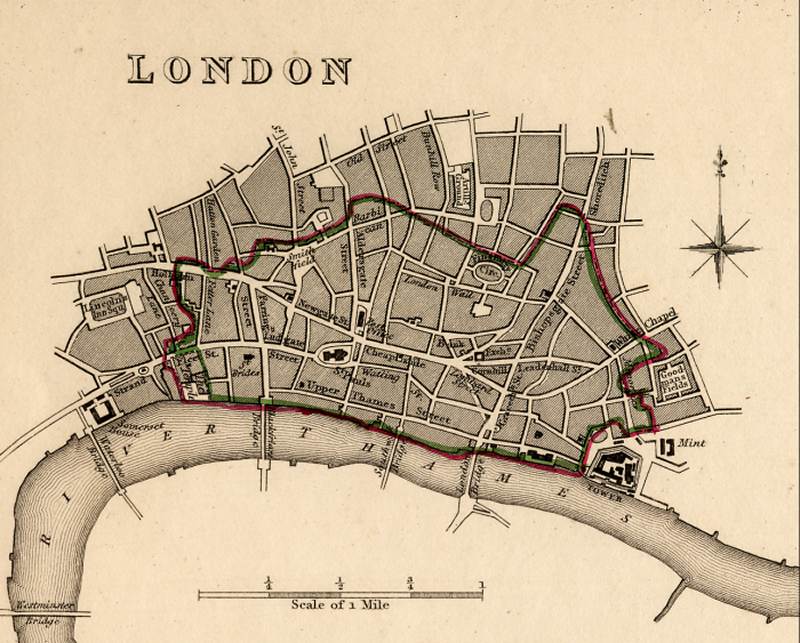
The map
below shows the City of London in about 1830. Click on the map for a
larger version.
|
|
|
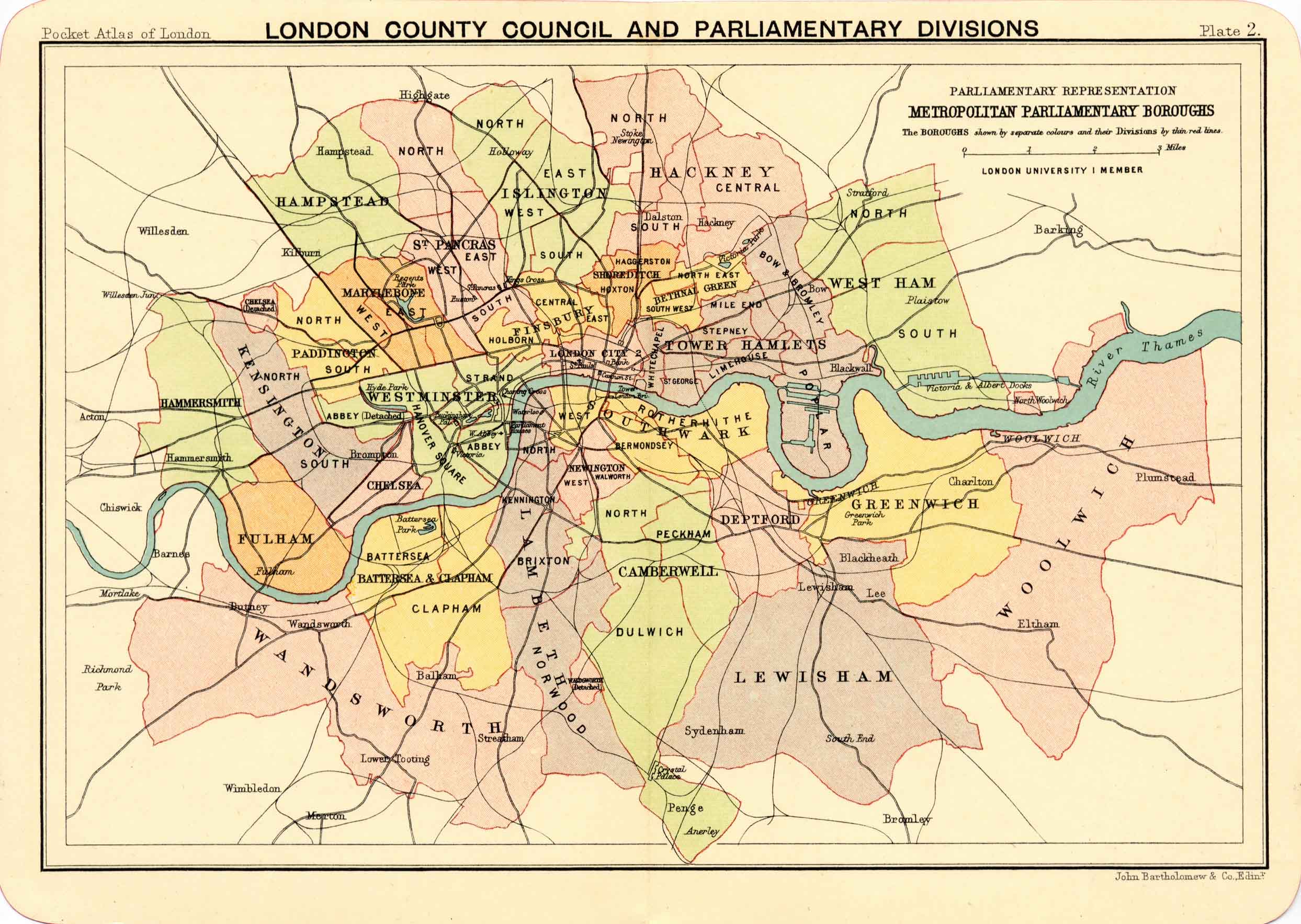
The map below shows the County of London in 1900 and its divisions into the various boroughs. Click on the map for a larger version.
|
|
|
Copyright © Family History Research |